Parks on the Air® Station Footprint and Park Difficulty Guide
Original author: W8MSC
Table of Contents
- Before you go to a park
- Read the POTA rules and documents
- Your station’s footprint
- Researching and selecting a park
- Activations prior to POTA
- Skill Levels for parks
Disclaimer This document is for amateur radio operators participating in the Parks on the Air® (POTA) program. It is not a complete checklist or procedure.
Always consult the current information and check with park staff as appropriate.
Prepare multiple ways to navigate safely; avoid relying solely on GPS.
POTA maps only provide general proximity to parks for your convenience. Do NOT rely on POTA maps for navigation!
Before you go to a park
POTA is suitable for new and veteran hams. POTA is an excellent way of developing your skills as a portable operator. Not only with making contacts on the radio but with antenna selection and design, power, logging, public interactions, and general preparedness.
New POTA participants benefit from working with experienced POTA elmers, but doing research and homework on your own is also a part of improving your skills.
POTA might seem daunting at first—but it doesn’t have to be, especially with some forethought and planning. With practice, your skills will improve.
Read the POTA rules and documents
POTA is about having fun, but there are some rules. Please read the POTA Rules and understand them.
Significant time is spent by POTA volunteers troubleshooting log files and answering questions. Please consult the documents (activator, hunter guides, and other resources) and ask for help if you need clarification on any item.
If you have topics to discuss or reports to contribute, please engage the other POTA community members. POTA is available on social media. See a list of all POTA social media sites
Your station’s footprint
A large station footprint can impose a significant impact on the park. Make sure your footprint is acceptable to the park staff. Be courteous to other park patrons and avoid blocking or restricting their activities.
Many parks prohibit wires or ropes from being put into trees or stakes in the ground. Don’t get a fine or a ticket.
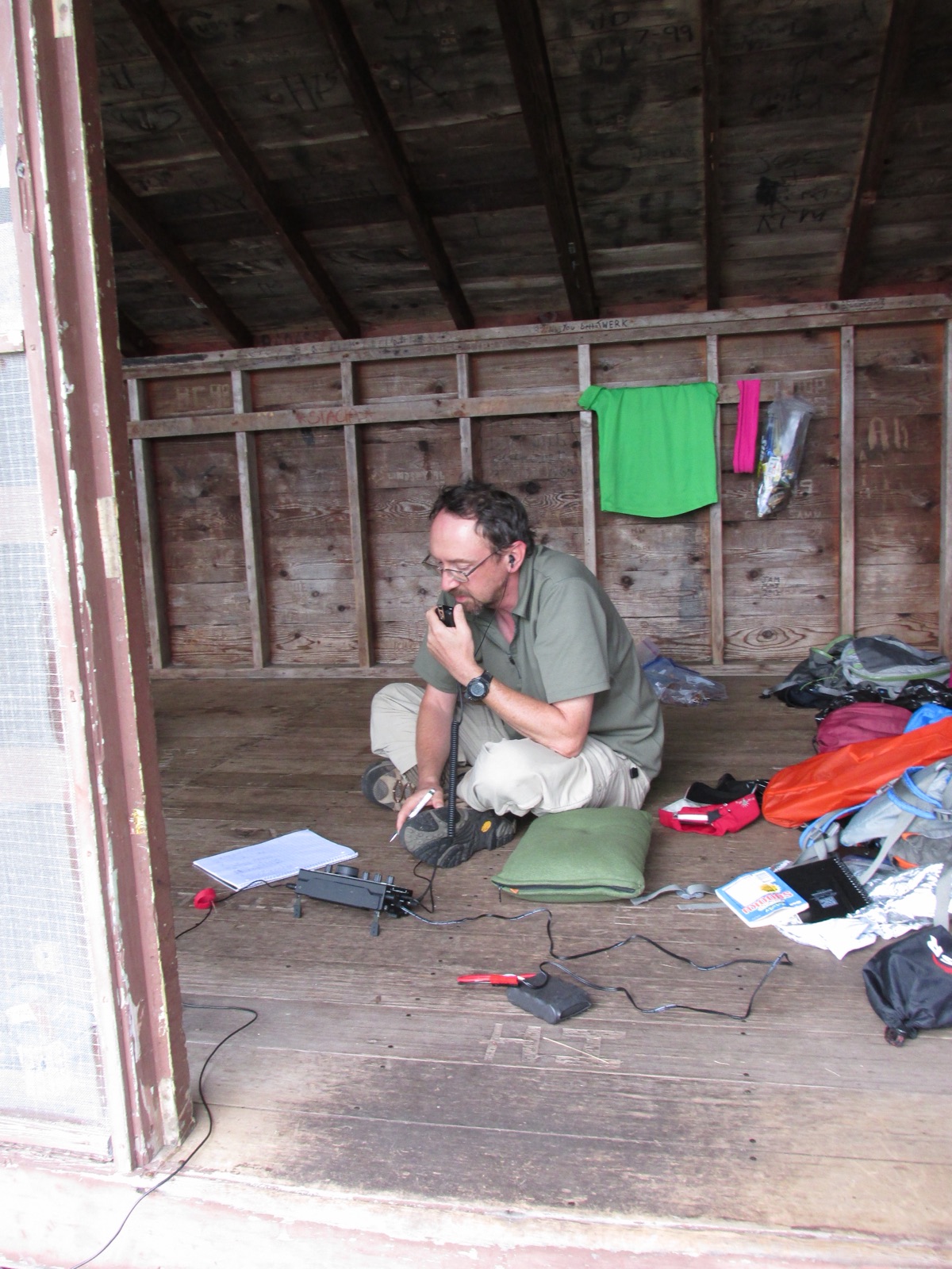
Backpacking station
A minimal station with a small QRP radio works well for backcountry hiking. Photo courtesy of W8MSC: W8MSC is at a backcountry shelter, Isle Royale National Park, US-0039.
Picnic table station
Picnic areas can make for great locations to set up your station if you have a small footprint. Be sure to keep your feed lines and wires flagged, as picnic areas tend to be highly trafficked by other park patrons.
K8ERS activating River Raisin National Battlefield Park, US-0714. Photo courtesy of W8MSC

Bicycle mobile station
Especially for urban hams, a bicycle adds a range of possibilities, from a small QRP HF radio and a wire antenna in a saddle bag to a 100W setup with a full-size vertical antenna with a mast on a small bicycle trailer. A bicycle also facilitates access to prime activation sites in a large park with the best propagation or the lowest noise. Some parks may have gate closing time for vehicles but remain open for the locals on foot, expanding the possibility for late shift activations.
Mobile station
Many parks have limited space and may require very minimal station footprints. Hamsticks or similar antennas are popular.
Mobile stations may be suitable for quicker park activations when you don’t expect to be in a park for enough time to deploy a larger footprint station or if the weather is unfavorable.
Photo courtesy of N3VEM
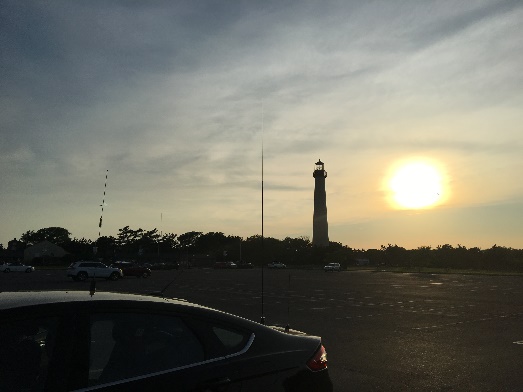
Some use a step-on tire mount or a hitch receiver mount to hold the antenna mast.
Campground station
Many parks have limited hours; some parks may not be open when you hope to activate the park. Reserving a campsite may be an excellent way to operate after a park’s standard closing time. However, the campground may be RF noisy. Observe quiet hours and don’t disturb other campground users.
Don’t use trees for your antennas on your campsite unless park staff approves. Trees receive significant wear and tear damage, leaving them susceptible to many diseases.
Pavillion station
A park pavilion or shelter may be available for rent, a good option for a club to use as it may have easy access to commercial power, parking, and restroom facilities.
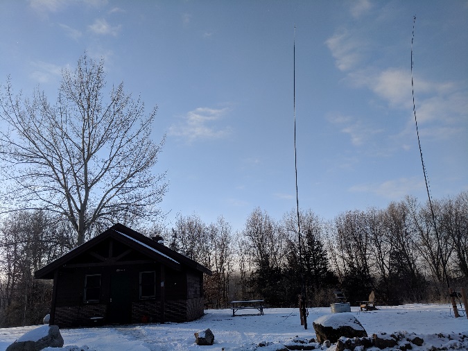
Large field-day station
A large multi-operator station will probably require a permit or group camping reservations. Contact park staff before your planned activation to coordinate special needs such as generators or large antennas.
Photo: W8RP operates from a cabin at Brighton Recreation Area, US-3384. Photo courtesy W8TAM.
Researching and selecting a park
You could research little or exhaustively, but thorough research and planning can minimize the trouble while in the park and increase your chance of successful activation.
Select a candidate park
Parks in the POTA program can be found in the map and park list.
Identify the county and grid squares where you expect to operate, as some hunters may ask. Save that info in your logs, LoTW station profile, etc.
Parks vary significantly regarding accessibility or difficulty and the park administrator’s policies. Some may not be as amenable to amateur radio as others.
Some parks charge admission or other fees. If you frequently visit your local parks, you might save by purchasing annual passes.
Check current conditions
Check current conditions at the park—weather, construction, detours, etc. Check with the park staff if you have questions.
Consider other on-the-air activities
Other amateur radio activities may be scheduled for the date and time of your activation.
Check the WA7BNM contest calendar website to see if there will be any contests that may impact your chosen bands or modes. POTA is not a contest; you may wish to avoid the bands/modes used by major contests. Other options include VHF, UHF, and satellites.
Activations prior to POTA
POTA welcomes your log files for QSOs predating POTA, as long as your activation was POTA-compliant! If you operated in a POTA park per POTA rules, your log would likely be accepted in the POTA system, even if your activation predated POTA. You or your club may have operated field day from a park years before POTA.
POTA was designed to be compatible with logs generated for the ARRL NPOTA 2016 event. Most logs will be accepted as-is, with minor changes resulting from NPS park types being modified since NPOTA ended.
Contact the help desk via email at help@parksontheair.com if you have questions.
Skill Levels for parks
Not all parks are equal in size, remoteness or amenable to amateur radio. Select a park to match your skill level.
Easy activations
Start POTA with accessible parks with short commutes, such as parks you are already familiar with or those already activated by several activators. Look up the activation history, and ask the recent activators for the latest info and recommendations.
Join another experienced POTA activator on activation and learn from them. POTA activators: take your club’s new hams out to a park and elmer them in portable ops!
Moderate difficulty activations
After you are comfortable with accessible parks and have a handle on logging, you may wish to try something more challenging.
Activating a distant park for the first time should begin with good research and planning.
- Scout the potential locations for your station
- Use Google Earth or similar tools to help choose areas within the park that would suit your station.
- Compare the overhead view with maps of the park to locate parking lots, picnic areas, campgrounds, or other such structures.
- Check with park staff if there are any seasonal closures or limitations.
High difficulty activations
Only after you have mastered simple and moderate difficulty parks should you consider advanced difficulty parks or “two-fers.”
Thorough research will be necessary for you to accurately locate park boundaries that are valid for POTA.
To determine boundaries, you may need to use detailed maps from the park’s managing agency, property plat maps, or electronic ArcGIS maps. GIS files can sometimes be obtained from state or federal government agencies.
The property you intend on activating must be public land managed by the government agency responsible for that park.
Some parks in the program, such as national or state forests, may be composed of many parcels of land with limited access or signage. Be aware that general-purpose maps may show inaccurate park boundary lines, or the lines may indeed include some private property.
To determine boundaries, you may need to use detailed maps from the park’s managing agency, property plat maps, or electronic ArcGIS maps. GIS files can sometimes be obtained from state or federal government agencies.
Some paid subscription services may give you access to private property (plat maps) within a website or cell phone app. GaiaGPS and OnX Hunt may be useful if you need to determine boundaries while traveling or operating in remote areas.
Some parks may be small enough to limit your station to a tiny footprint. Only pedestrian, bicycle, or mobile stations may be allowed due to the limited space available. If so, coordinate with park staff to select a suitable location.
Seasonal closures may limit or prevent access. Check with park staff to inquire if the parks are still accessible, even if facilities have been shut down, or if any roads or entrances are blocked.
If a permit is required, apply well in advance for park staff to review. Be willing to take “NO” for an answer. Some parks may not approve your permit.
Prohibited parks
Some parks may not be available to activate due to various reasons.
Sensitivity
Parks established for cultural or historic commemoration may not be suitable for some stations. Discuss your plans with park staff to ensure you do not violate any of their rules.
Radio Quiet Zones
Radio quiet zones exist in various countries, which may limit or prohibit radio use within some geographic areas.
For more information see the offical website and the radio quiet zone information on wikipedia.
POTA parks exist within the US radio quiet zone. If you intend on activating a park in this area, please contact park staff before your planned activity to say what you’re doing and that you’ll be using amateur bands. The frequencies used by radio telescopes are out of our spectrum. The closer you get to the observatories, it becomes the more significant issue because of spurious emissions.
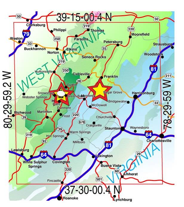
There are easily a dozen or so parks in this quiet zone. A couple of examples would be the southern portion of US-0064 (Shenandoah NP), the northern portion of US-4564 (George Washington and Jefferson NF), or US-0632 (Monongahela NF). All radio emissions, including cell phones, are prohibited within 20 miles of the observatory.
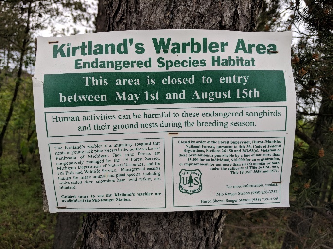
Seasonal Closures
Parks may be closed seasonally for staff availability, construction, and environmental or wildlife impact, among many common reasons.
Entering closed parks against staff guidance is considered trespassing and will disqualify your POTA activity.
This park was closed for seasonal bird nesting. Photo courtesy of WT8J
Failure to Plan
If you fail to plan, you are planning to fail! (Benjamin Franklin)
Doing little or no research before your activation risks being turned away because of season closures, restrictions, or construction. This method will give you experience, but probably not the POTA kind. Know before you go!
GPS coordinates and Grid Squares
The POTA map provides GPS coordinates to parks. These are only suggestions of the general area where a park may be located and are not suitable for navigation.
Parks may also be extensive. Many parks’ boundaries overlap multiple counties, grid squares, or locations.
It is up to the activator to determine how to best access the park and what county/grid square they are in.
Feedback
Send any suggestions you may have about this document please send email to help@parksontheair.com.
Acknowledgments
Thanks to all the activators and hunters that participate in the program.